
by Kelly McClinton
1. You’ve Got a Lot to Do
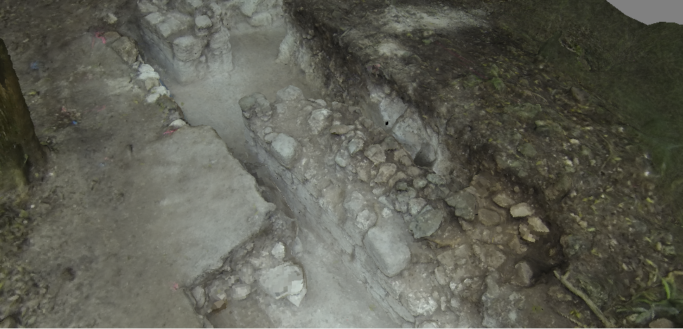
Let’s face it; you may only have a couple seasons at your current excavation site. This summer may even be your last dig season. Drones can help you survey and map your site faster than many other tools on the market. Steven Wernke, an archaeologist at Vanderbilt, says that drones can vastly increase the speed at which you collect topographical information:
If you’re interested in gathering topographical information quickly and precisely, drones are the perfect solution.
2. You Want to Protect Your Site
Sadly, looters and thieves are still a real threat to modern-day archaeology. An excavation site needs constant oversight and monitoring, both during on and off season. Drones can help set boundaries to protect endangered sites and watch over them.
Drones can also create digital records of your site that can help build awareness and aid in the reconstruction of any damage. If you’re interested in protecting your excavation site, drones can definitely aid in the effort.
3. You Can Always Use a New Perspective:
Finally, a fresh point of view is priceless, whether it comes from the latest documentation, a newly discovered artifact, or cutting-edge technology. Case in point, archaeologists in southern Peru recently used a digital model to gain a new perspective on their petroglyph site. Viewsheds generated by the digital model provided additional regional context that connected their site to a nearby ancient footpath. The team specifically stated in their report that the new discovery was the result of a fresh perspective created by the digital model:
“In the case of Chichictara, it was the change in of perspective, obtained by the application of new documentation technologies that evoked further contextual insights. As in the case of the decipherment of Linear B, information about a frame of action and life form, mainly derived from latent structures, is a key for understanding.” (Fux)
Drones are a great way to get a new perspective on your research. Aerial photography and 3D mapping enable us to see an excavation site in, quite literally, an entirely new light.
To learn more about how drones and aerial photography can help your research, visit our website:
____________________________________________________________________________
P. Fux et al., “Perspectives and Contrasts: Documentation and Interpretation of the Petroglyphs of Chichictara, Using Terrestrial Laser-Scanning and Image-Based 3D Modeling” in New Technologies for Archaeology: Multidisciplinary Investigations in Palpa and Nasca, Peru (Berlin: Springer-Verlag: 2009), 372.